Tuesday, June 19, 2018

Back in Florida...But Not Quite Home!

Upon our arrival in Florida after crossing the Gulf Stream, we needed to get to Key West in short order so we could check in. We spent the first night at anchor in Card Sound, on the inside of North Key Largo. The next morning we left early, as we were aiming for Bahia Honda, about 70 miles south.

Good ol' Florida sunset - Card Sound
 
We had a really great sail, with light winds, but enough for a peaceful meander down the chain of islands that make up the Florida Keys. Our only hiccup occurred when we were sitting down for lunch, and Dave noticed that the auto pilot was making a strange sound. He sprayed it with some silicone spray, and then decided to continue hand steering. It felt like something was caught on the rudder or propellers. Luckily, it was calm enough for us to completely slow down, and Dave jumped in the water to have a look, and see if anything was caught. There was nothing. After continuing to alternatively hand steer and put it on auto pilot, he came to the conclusion that our auto pilot was just tired! It looks like the hydraulics may just be worn and will need replacing. After a whole loop around the world, and an additional trip across the Atlantic (by the previous owner), plus the trips we did before leaving on the circumnavigation, we reckon the auto pilot has more than served us well! We mainly hand steered from then on, to minimize any use of the auto pilot.

Sailing down the Florida Keys.  Familiar marker buoys help us to stay in deeper water; dolphins come to greet us...it never gets old!  Gaby enjoys the calm sail 

The first thing we noticed when we arrived at Bahia Honda was the lack of vegetation. We keep forgetting how hard all these areas, including the Florida Keys, were hit by the devastating 2017 hurricanes Irma and Maria. We had been to Bahia Honda quite a few times, both on Cool Runnings and our previous boat, and the walk up to the bridge and the view down to the anchorage was always through thick palm trees. Now the trees are gone, and a good portion of the old bridge looks like it was damaged. The anchorage is nestled between Henry Flagler’s old railroad to Key West and the Overseas Highway, that runs from Key West to the mainland, linking all the islands together. 

Arriving at Bahia Honda.  The old railway bridge in front with the new highway behind.  A gap in the old bridge provides an entrance into a calm anchorage
 
Henry Flagler's old railroad to Key West

We stayed the night, and didn’t even go ashore, as we had not officially checked into the country yet. The following morning, we left early again, and headed down to Key West. It was a shorter trip, with about 40 miles separating the two destinations. We had dropped our sails and were motoring in the busy channel past Mallory Square and the busy Key West waterfront. A big cruise ship was docked in front of the Hilton Key West Marina, from which we departed in April 2016. Benjamin was at the wheel when we crossed our wake, our current track crossing over the one we made back then, completing the loop around the world! It was an emotional moment and we felt extremely proud of ourselves for what we had accomplished!

Celebrating our arrival in Key West and our moment of circumnavigation!

Everything was familiar now. We went back to the fuel dock where we had filled up before we left. We enjoyed walking up and down Duval Street.  We walked around Mallory Square, watching the street performers as we had done before we left. Except now we were feeling relieved, happy, proud. Then we were feeling excited, somewhat anxious and a little bit overwhelmed!

Meandering around Key West
We allowed ourselves one night at the Galleon Marina, and then headed out at lunchtime the next day to start the final leg of our journey back home. We retraced our steps and sailed to Marquesas Key, roughly half way between Key West and the Dry Tortugas where we anchored for the night. The shallow water was crystal clear and provided a good opportunity to clean the hulls. They were not too bad, but Cool Runnings likes a clean bottom (don’t we all?! 😆), so we spent a few hours in the water giving her a good scrub. The following morning, we headed off to the Dry Tortugas, one of our favorite spots in Florida.

A breathless evening at anchor at Marquesas Key

It's become Gaby's tradition to blow our conch at sunset.  Ben pops his head out of his cabin hatch to watch the sun go down
In Key West, Dave had purchased a book called “The Slumbering Giant” about the history of Fort Jefferson. It was short, full of old pictures and an easy read, so we all managed to read some, if not all of it before we arrived back at the fort again. While we had known most of the key facts about the fort, reading the book provided us with a little more insight into, and appreciation of, the enormity of building the fort, and the conditions of life at the fort back in the late 1800’s.  Let’s just say I’m very glad I live in the 21st century!

Our drone captures this image of Fort Jefferson from the air

Construction began in 1846 and continued for some 30 years, when, in 1874 the fort was abandoned by the army.  It was never completely finished, and nor fully armed.  It was never attacked, and a shot was never fired from it.  During the Civil War, the fort was used as a prison, mainly for Union deserters, its most famous prisoner was Dr. Samuel Mudd, the physician who set the leg of Lincoln's assassin, John Wilkes Booth. 16 million bricks were used to build the fort, and it has 2,000 arches!  The engineering of building this fort, with foundations that continued to sink, let alone the logistics of getting the materials to this remote location, is staggering.  We have visited many times, and never tire of its history nor its beauty.

Images of Fort Jefferson:  From the inside looking at one of the walls; the bricks, especially those facing the ocean side, are subject to some serious erosion.  There was a lot of restoration work going on while we visited this time.  Arches and moats and a selfie on top of the fort walls

On Sunday June 3rd in the late morning, we took the boat over past Loggerhead Key and tied up to a mooring buoy which marks the wreck of the Windjammer. We had done this on Benjamin’s 12th birthday before we left, but on that day, the water was cold and the current was incredibly strong. Only Dave was able to really snorkel the wreck, while Ben, Gaby and I sat in the dinghy, ready to pick him up. This time, the weather was perfect, the water was warm, and the current was non-existent. In other words, it was a perfect day to snorkel the wreck.

The vessel has been identified as the Norwegian Avanti, which sank January 22, 1907 while en route to Montevideo, Uruguay from Pensacola. The Avanti, originally named Killean, was an iron-hulled three-masted ship built in 1875 by the British company, John Reid & Co. It had a length of 261.4 feet, a beam of 39.3 feet, a draft of 17.5 feet, and a gross tonnage of 1,862 tons.  This wreck site guide, taken from the National Parks Service website, identifies all the pieces of the wreck:


While the kids went off on their own, Ben on a paddle board and Gaby swimming alongside, Dave flew the drone to capture some incredible shots!  If you turn the wreck guide image above, upside down, you can clearly see the wreck in the water below!

Cool Runnings next to the Windjammer wreck.  The midship wreckage with the bowsprit and the main mast can be clearly seen...the stern wreckage is closest to our boat!  

The guide turned upside down to correspond with our photo of the wreck

We were lucky that there was no wind and the water was crystal clear.  The drone captured some amazing shots!

Ben paddles out on the SUP, while Gaby swims behind, exploring the wreck.  Bottom right:  The drone captures Loggerhead Key, with Fort Jefferson way in the distance

We soon joined them, and together we explored the wreck, not caring about the huge Barracuda eyeing us, or the nurse shark resting on the sandy bottom. How times have changed!! Both Gaby and Ben dove to the bottom, swimming in and out of old port holes, checking out the coral, schools of fish, and identifying what parts of the ship were now resting on the sea floor. It was amazing to see how they have progressed, how comfortable they were in the water, and how they were able to appreciate such and amazing sight…not only what it offers us now in the form of recreation, but to understand the ship as it was in its day, how it hit the reef and sunk, and what it must have been like for the captain and crew aboard the Windjammer.

Diving the wreck

Once back at anchor outside Fort Jefferson, we waited for the early evening, when the heat was a little more bearable, before we explored the fort again with our new-found knowledge. We noticed that there were many new informational signs posted around the fort, and a big lighthouse restoration project was underway. While we could definitely notice additional erosion on the windward facing fort walls, we could see that a lot of work is being done to restore the fort and keep it from falling into disrepair. 

One of the new informational signs; Fort wall and moat; and the weathered bricks


That evening, back on the boat, Dave did a weather download, and we started seeing the possibility of some weather coming our way. While we had initially planned to stay 3 – 4 days in the Dry Tortugas, we didn’t want to be stuck out there with our homecoming so close, so we decided to leave the following day, Tuesday, June 4th (which, coincidently, was our 24th wedding anniversary!). Our destination, Captiva island, was 124 miles away. Our typical 24 hour distance is 150 – 160 miles, or we can do about 80 miles in a full 12 day. In order to arrive in the morning, we needed to leave at about lunchtime, so we did a last outing to Loggerhead Key, where Dave flew the drone again. While he was flying, I heard some shouts of amazement…he had captured a huge Hammerhead shark chasing a Tarpon in very, very shallow water! That quickly put an end to any thoughts of jumping in the water for a quick swim!!

Cool Runnings anchored off Loggerhead Key; the hammerhead shark the drone captured - look how close it is to the beach!  Do you recognize the lighthouse on Loggerhead Key?  (Take a look at the header at the top of this blog page!)

We did go ashore and went for a walk around the island. We noticed some major erosion here too, and while we remember some great snorkeling on the reef on the far side of Loggerhead in the past, there was no coral, and only rock left. We were so hot that halfway around the island, we decided to go for a quick dip. Keeping a sharp lookout for the Hammerhead shark, we sank into the cool water…only Ben forgot to take his phone out of his swim shorts pocket, and it sank to the bottom, where it rested for a few seconds before he realized what had happened! Even though we rinsed it as carefully as we could with fresh water, and immersed it in rice for a day to two to absorb any liquid, the damage was done. It only took a tiny bit of salt water to get into the phone, and it fried the circuit board. The phone, sadly, was as dead as a door-nail. Poor Benjamin…both he and Gaby had put in $100 of their own money in Australia to buy these phones…their link to their friends and the outside world.

Beauty on our doorstep:  Cool Runnings at Loggerhead Key, Florida
Exploring Loggerhead Key.  Erosion caused this pump house to literally break in half!

We anticipated a motor sail in very light wind all the way back across the Gulf of Mexico, but after a few hours, the wind actually picked up, and we were able to sail all through the night…the last nightshift of our journey!! We negotiated the pass into Pine Island Sound, looking for marker buoys that provide a safe passage past the ever shifting sandbanks, and with breaking waves all around us, we were thankful for the green and red buoys! We had arrived much earlier than anticipated due to the unexpected wind assist, so we sat outside the South Seas Marina debating what to do. We had booked a night at this much-loved resort. We have spent many a fun-filled holiday here, and the kids were looking forward to the resort’s water slides! Dave took his time getting mooring lines and fenders ready, while I stayed at the helm and hovered. Just before 8:00am, he tried the marina on the VHF, and amazingly enough, the person who had taking our booking over the phone the day before, answered the radio! He was just arriving at work and was walking to the office from his car. He called us back within a few minutes with a slip assignment. No problem accommodating us so early in the morning! We were met by two dockmasters who helped us tie up, and once again, Cool Runnings and crew were in a familiar spot!

Sunrise arrival at Captiva Island, and Cool Runnings at the South Seas Marina

We made the most of our time at South Seas, enjoying the beautiful grounds, taking multiple rides on the water slides, and taking the trolley into the little holiday town of Captiva, where we enjoyed great Mexican food at Cantina Captiva, another place we had frequented before! We watched the sunset over the Gulf of Mexico, from the land this time and continued making plans for our homecoming. From the previous blog posts you’ll know that we kept moving up the date up, and it was here that we downloaded the weather again, and decided one last time, to make the final push home, to be back by Friday, June 8th. We were enjoying the familiar sights, but by this time, it was almost like we were just killing time, and we were so close, it seemed silly to stretch it out any longer.

Taking the trolley from South Seas to Captiva;  Ben and Gaby at Cantina Captiva; Gaby coming down the water slide and sunset at South Seas

After a last side down the water slide, we left the marina and entered Florida’s Intracoastal Waterway. We raised the main and unfurled the jib and had a fantastic sail on the smooth, flat water. The wind was about 15 knots from about 90 degrees and we reached all the way down the channel, avoiding the shallow water on either side. We could see storm clouds brewing on the horizon, and watched them to see which way they were moving…definitely towards us! After about an hour’s sail, and when the storm looked to be a little closer, we made the decision to drop our sails and we did this with possibly a minute to spare. The storm was upon us in no time, with heavy rain, and wind sustained 30 knots!! I suddenly remembered Florida’s afternoon thunderstorms! We had just arrived at our destination of Cabbage Key, but with the strong wind and pouring rain, we just dropped anchor just outside of the channel to wait out the storm. Once it passed, (and it did so pretty quickly), we weighed anchor and moved to a better spot where we settled in for the afternoon.


Before...

During...

And after the storm!

The following morning, we took the dinghy to Cabbage Key, a small island with an old Inn and Restaurant on it. It also has one of areas oldest water towers that is still standing. Most others have been destroyed in hurricanes, but this one has stood the test of time and weather. We treated ourselves to breakfast at the little restaurant, and climbed the water tower, as we have done many times before!

Cabbage Key is on the National Register of Historic Places

It was then on to our second last stretch before reaching home. We are able to navigate the Intracoastal waterway as far as Venice, after which time, we need to exit and continue sailing on the outside, as there are fixed span bridges that we don’t fit under. The majority of the Intracoastal Waterway bridges are 65ft high, and our mast is 70ft high. We had a couple of bascule bridges to pass through which opened either on a set schedule or on demand. We soon heard another boat on the radio asking for a bridge opening and soon we could see it. It was another catamaran. We were sailing (pretty slowly) and they were motoring, and soon they caught us up. We chatted on the radio and discovered that we had anchored together at Fowl Cay in the Bahamas! We recognized the dog they had on board! So we continued to move along together, allowing the bridges one opening instead of two.

Ben at the helm as he takes the boat through one of the bridges on the Intra-Coastal waterway
Close to Venice there are 2 bridges in very close succession, and the last 2 before we spilled out into the Venice inlet. We passed through the first bridge together with Ohana, the other catamaran. Then we sat and waited for the second bridge – the last bridge we had to get through. The bridge tender said he was going to open for us, and we got ready. And then nothing happened. Soon the bridge tender was back on the radio. Only one side of the bridge was operational, and he couldn’t lift the other. So we waited. And waited. And waited. Back and forth on the radio. He said it would take a while as he needed to wait for maintenance to come and fix it. The space was tight for 2 big boats to try and hover and we eventually decided we would tie up to a small public dock and Ohana would raft up next to us. It was so frustrating being that close, and not being able to move forward! Just one more bridge and we would be free, but it was like being imprisoned!!

Ohana waiting for the bridge that couldn't open!

Eventually, we heard the bridge tender on the radio, saying he would try and lift the bridge for us, but only the one side that was operational. We would have to squeeze through, and make sure our masts didn’t hit the top of the arm that was up. Ohana went first, and we squeezed through behind them. We were free!!

Ohana squeezes through one side of the bridge as we follow shortly behind.  Ben and Gaby check to make sure our mast doesn't touch...it's a lot scarier when you're on the boat looking up!!

We continued along to the Crow’s Next Marina where we tied up, almost in exactly the same place we had on April 17th, 2016. This was our first stop on our trip when we left, and it would be the last on our return! We enjoyed a lovely dinner at the Crow’s Nest Restaurant, and a restless night at the dock. Another storm came through with strong wind and swell coming in from the ocean. We were up a couple of times during the night checking and adjusting the lines and moving fenders. This was one thing I would not miss about cruising! We left early the next morning, motoring into the now calmer ocean, ready for our very last stretch, Madeira Beach, about 50 miles away! It was the last day of our circumnavigation. We would be home that afternoon. It was hard to comprehend! But Mother Nature had one more test for us before we were finally allowed to go home…


Thursday, June 7, 2018

Crossing the Gulf Stream

As a quick prologue to this post, I just wanted to let our local friends know that we have made one more change to our homecoming!  We will be coming through the John's Pass bridge at about 3:00pm tomorrow, Friday, June 8th.  If you happen to be caught at John's Pass bridge around that time, it'll be us passing through ~ give us a wave! 

*******⛯⛯⛯⛯⛯⛯*******

Getting from the Bahamas to Florida, should, in theory, be a “piece of cake”. A little over 50 miles separate the two countries, the closest point of entry/exit, are the small islands of Bimini, and further south, Gun Cay and North and South Cat Cay. In between, in this small stretch of Atlantic Ocean, the Gulf Stream current brings warm water from the south, to cooler waters in the north, ripping at a rate of up to 3 knots. This makes it a stretch of water that needs to be crossed with care.

The flow of the Gulf Stream current taken from our weather routing program.  The intensity of the current, and the position of it will change, but there is always a strong current between Florida and the Bahamas.  The red arrow on the lower pictures shows roughly the relatively short crossing that we needed to make.

We left the Berry Islands on Memorial Day, May 28th, in rainy, overcast weather, the remnants of Tropical Storm Alberto still in the air. We had to cross the shallow Bahama Bank to get to Cat Cay, about 80 miles away. On a sunny day, it would probably have been beautiful, the shallower water always reflecting so blue on a clear day, but we had the far outer storm bands still moving north, resulting in fresh winds and grey, heavy skies.  It was an uneventful day, a little bumpy at times, but roughly 12 hours later, we arrived at tiny North Cat Cay, to anchor for the night, and make the Gulf Stream crossing the following day. 

Arriving at Cat Cay

Lighter wind was forecast, as often is the case after a storm passes, and we were OK with that. Heavy winds, even in the right direction, can whip up the waves, and with the strong Gulf Stream current, make for unpleasant, if not hazardous conditions. Wind in the wrong direction, fighting the strong current, make it an absolute “no-go” zone. Light, southerly winds were forecast, so we had wind with current, and were set to go.  Leaving Cat Cay we still had a couple of squalls to negotiate, and we put a reef in the mail sail and furled the jib to 60%. 

A stormy start to the Gulf Stream crossing

 After a few hours, the storms passed, and the wind died. We shook out the reef and unfurled the jib, but it was still not enough to keep us going…and we started to feel the effects of the current. With no wind to help us, even motor sailing, we were starting to be swept sideways! We pointed further south than our intended destination of the bottom of Key Largo, but the current swept us to points north of Miami!

This shot of our chartplotter shows how we were being swept sideways.  The yellow circle with the "X" in the middle is where we were trying to get to (our waypoint).  The red arrow shows the direction the boat was pointing in (our heading), and the green arrow points to our COG (course over ground), ie. where we would end up!  The purple is bad weather that is being transposed from our radar (top left).

Gaby was the first to cry “Land Ahoy!” when she spotted the high rises of Miami sticking out like building blocks far on the horizon! We also knew we were back in US Waters when we heard the transmission on Channel 16, of Coast Guard Cutter 04, warning vessels in the area to stay clear. They were conducting live fire gunnery exercises, and after providing their position, gave a radius that had to be clear: 5,000 yards for vessels, 10,000 feet for any aircraft. We were passing to the north of them (we had a visual of the cutter, but they had turned off their AIS signal). Dave radioed them to make sure we didn’t have to change course. They said we were fine, but if we wanted to alter course slightly away from them, that they would appreciate it (increase the safety zone slightly, they said!). Soon we could see the plumes of smoke as they conducted their exercises. 

The Miami skyline appears on the horizon and plumes of smoke are seen as the Coast Guard Cutter conducts live fire exercises

This went on for a few hours, and certainly kept us entertained and passed the time. In normal conditions, 50 miles, depending on our speed, would take anywhere from 6 – 8 hours for us to cover. Due to the current, we were, at times, making speeds of 2 – 3 knots VMG (velocity made good) to our destination. That means, although we were going 6 knots through the water, our calculated speed to get to our end point, was half, or less of that! In other words, it was taking forever!!!

We eventually managed to cut free of the current at about 6:00pm, about 12 hours after leaving the Bahamas! And we still had about 12 miles left to go to get to a channel that would allow us to get to the inside of Key Largo, where we could safely anchor for the night! We had daylight until about 8:00pm, so once free of the current, we motored south until we found the channel at Angelfish Creek, where we negotiated some shallow water, and saw some beautiful spotted eagle rays in the water, and stoic, white egrets standing like statues in the mangrove edge. This was all familiar. We were back in Florida. We were home.

Our actual track across the Gulf Stream and down to Key West.  The red dotted line shows the route we would normally have taken.  The blue line shows our actual track, and how the current swept us sideways towards Miami!

Wednesday, June 6, 2018

How Quickly the Plans Change

Our return home keeps getting earlier and earlier!  Originally, it was going to be end of June, then we moved that up slightly to the second last weekend in June, and then, once we arrived back in Key West, we settled on a leisurely 2-week cruise up the west of Florida, our old stomping ground, and planned a homecoming for Saturday, June 16th. 

A few days ago, when we were anchored in the Dry Tortugas, we did a weather download for our trip across the Gulf of Mexico to Sanibel Island.  The forecast models started showing another closed cell low-pressure system forming in the Gulf, and we knew we'd have to watch this one too, so decided back then to accelerate our departure from the Dry Tortugas.  This morning, Dave downloaded the weather again, and this is the outlook for next week!

Forecast of the location of the low-pressure system next Thursday, June 14th.  The grey in the center of the system shows winds of 60+ knots!  We were planning on coming home on Saturday, June 16th.  We're speeding up!!

This system shows winds of 60 knots in the grey area in the center of the circle, and according to this model (GFS), its heading our way!  Now, again, its just one model showing this intensity, but we don't take any chances.  Something is out there, so we are accelerating, and getting to shelter!  We are currently in North Captiva, near Fort Myers.  We will now be safely tied up at our home dock, in Madeira Beach on Saturday, June 9th, another week earlier than planned.  The pull of home is strong...the weather just gave us a little push to get there more quickly!

Tuesday, June 5, 2018

The Bottle That Went Around the World

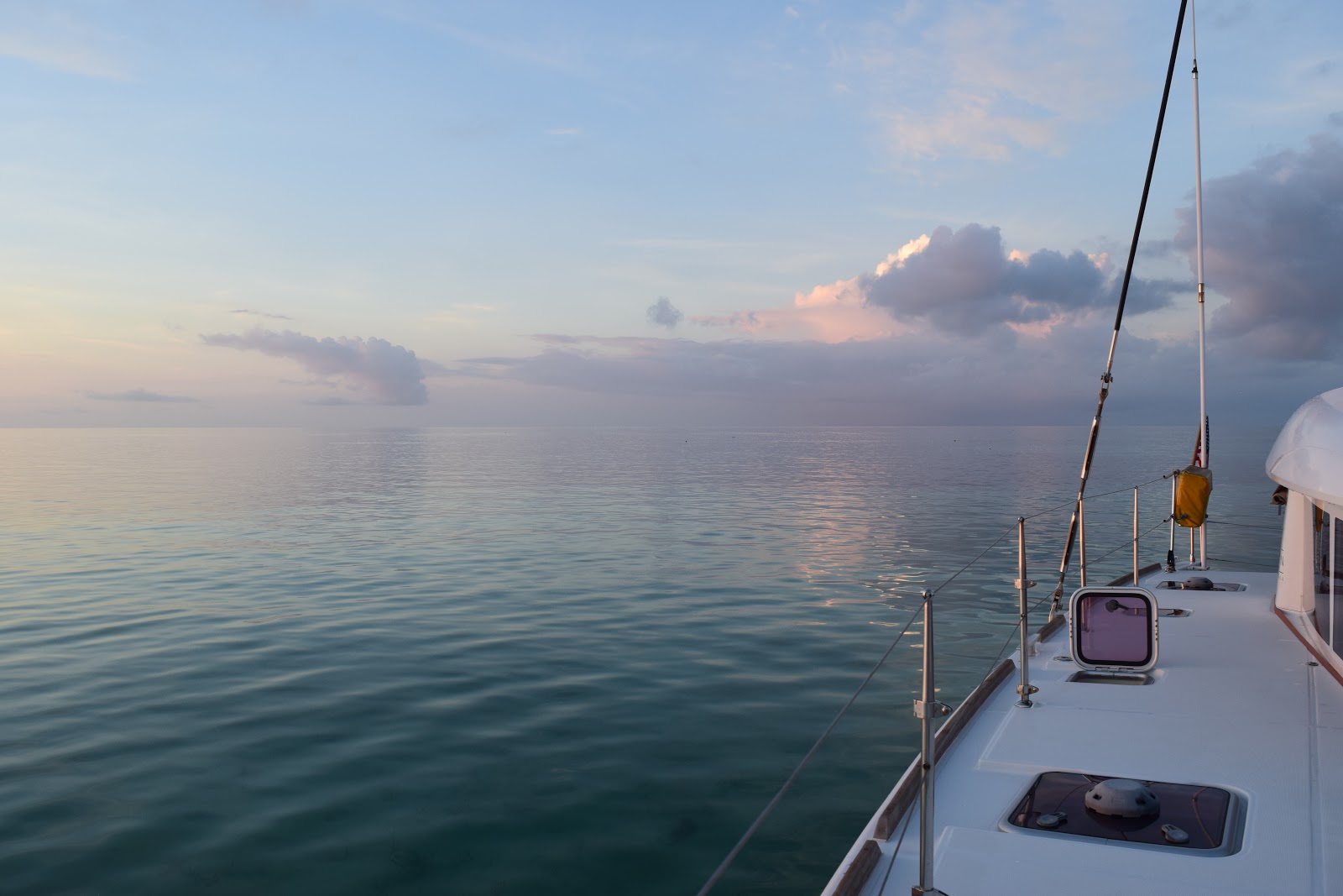
When we left on our circumnavigation in April 2016, our first stop (or our last stop in the USA), was the Dry Tortugas, about 70 miles west from Key West, Florida. Anchored off the magnificent Fort Jefferson, we saw another Lagoon catamaran, a Lagoon 440 anchored not too far from us. Dave and the kids went over to say hi, and chatted for a while, and so we met Gary and Brenda aboard s/v Pandion. Before we left, Gary dinghied over and very kindly presented us with a bottle of champagne and wished us well on our journey around the world.

s/v Pandion (left) and s/v Cool Runnings anchored in the Dry Tortugas, FL in April 2016

We had planned to drink the champagne on many occasions: when we crossed the Equator from North to South; on our first year anniversary; when we crossed the Equator the second time from South to North; on our second year cruising anniversary, but the timing was never right, and the bottle remained in our small locker that safely holds a few glass bottles.

The Bottle that went around the World!

 Fast forward two years, and we were heading back towards the USA. One day, not long after we arrived in the Bahamas, we received a really nice email from Gary and Brenda aboard s/v Pandion. In the 2 years that we had been gone, they had retired, sold their house, moved aboard Pandion and were now cruising in the Bahamas! All this time, unbeknownst to us, they had been following our journey around the world on the blog! They had hoped we could possibly meet up somewhere in the Bahamas, but we were on opposite ends…they were cruising the Bight of Abaco, and we were down in George Town on Grand Exuma. We said we’d stay in touch, and hopefully meet up along the way.

When we made the decision to skip the Abacos, and go to the Berry Islands, we thought that unfortunately we would probably miss meeting up with s/v Pandion. Amazingly enough, we received an email the day we were leaving Nassau for the Berries from Gary, letting us know that they were heading to the Berries, and they were thinking they would probably miss us, since we’d said we were going to the Abacos! And so luck would have it, we were both heading to the Berry Islands from opposite directions!

We finally met up with Pandion on Thursday, 24th May, 2018 in Bullocks Harbor, Great Harbor Cay, Berry Islands, Bahamas! We were both sheltering there from the tropical cyclone Alberto, that had been threatening to come our way for the last week, and we were still unsure of its track. On our second evening together, we finally uncorked the bottle that Gary and Brenda had given us two years earlier, and that had accompanied us the whole way around the world! There was no better celebration to finally drink the champagne, than to share it with the wonderful couple that had given it to us! Thanks, Gary and Brenda for the great time we spent together in Great Harbor Cay! We are so glad we were finally able to meet up, and to share the special bottle with you! We wish you all the very best with your future cruising, and we’ll be following your blog http://pandionsail.blogspot.com !!

CHEERS!  Finally drinking the Champagne with Brenda and Gary


Cruising the Berry Islands

Prior to our rendezvous with s/v Pandion, we had spent a week exploring the Berry Islands. After anchoring off Rose Island, near Nassau for one night, we left on the morning, Friday, May 18th and headed towards Bond Cay in the Berry Islands. The wind was blowing 15 – 20 knots and the sea was quite rough. We still flew our spinnaker, as the wind was directly behind us, and we made good speed towards the Berries. Prior to arriving at the pass in Bond Cay, we snuffed the spinnaker and motored the rest of the way in. We had wind against current, with the tide ripping out through the pass creating some uncomfortable seas and rough conditions. We carefully motored in, and were happy to find shelter behind Bond Cay as soon as we turned the corner.

Top:  Entering the pass at Bond Cay.  Bottom:  Outside the pass, the waves break onto the rocks, inside, we finally find some calm water

But the outlook for the foreseeable future was bleak…the rain and wind that we had experienced in the Exumas looked set to continue for the rest of our time in the Berries. Since we couldn’t control the weather, we decided to make the best of what we did have, and that was a weak cell phone signal, so we spent the following day anchored off Bond Cay and did blog updates, caught up on email, did school, read and watched movies. There was not much at Bond Cay, so even a dinghy ride in the rain and wind wasn’t warranted!


A screenshot of the weather outlook when we arrived in the Berry Islands!


The lee of the Berry Islands is extremely shallow, but we’d checked the charts and it looked like we could stay on the inside from Bond Cay to Hoffman’s Cay. On Sunday, May 20th, we relocated from Bond to Little Harbor Cay. The weather was slowly improving, and it was here that we explored the beach that prompted the kids’ reports on plastic. We stayed anchored here for 2 nights, continuing to do schoolwork in the mornings, and exploring in the afternoon. We were enjoying the Berry Islands. Although not as stunningly beautiful as the Exumas, they were still very pretty, and we were loving the solitude! There was nothing out here, including very few other boats.

Exploring Little Harbor Cay.  The image on the bottom left is a satellite image of the Berry Islands.  The light blue / white areas are the shallows and sand banks...as you can see, there are many!  And, by the way, don't the Berry Islands look like a Conch Shell?!  Gaby displays this beautiful Conch that we found on Little Harbor Cay

We were also closely watching the weather. There was a closed low pressure cell that we had been monitoring ever since we had first seen it on one of our weather models back in Cambridge Cay in the Exumas. What was frustrating us was that none of the weather models were agreeing on its path. The GFS model had it moving in a westerly direction, directly over us, with winds up to 45 knots. The European model showed it as a weaker system, moving eastwards. The other 2 models didn’t even show it at all! As the days went on, we learned that it had become a named storm, Alberto, an early storm forming outside of the “official” hurricane season. It looked like we would experience its impact on Friday and Saturday, May 25th and 26th. As a precaution, we decided to book a berth in the Great Harbor Cay marina, which had the reputation of being one of the safest marinas in the Bahamas, due to its location in a hurricane hole.

While the storm was looming, the weather where we were was actually improving! (the calm before the storm?!). We moved neighborhoods once again, and edged our way through the shallow banks to anchor off Hoffman’s Cay, a really beautiful spot! Getting there proved to be an adventure all in itself, when we decided to take a short cut, close to the edge of the Cays. The charts did show some shallow water, but it looked to be doable. And it was, except for one hairy corner where our master mariner Dave went around backwards! Yes, backwards, the reasoning being that if we ran aground, we would have some better thrust in forward gear on our engines to go forward and get us off the sand bank, as reverse thrust is not as powerful. We bumped a few times on the sandy bottom, but slowly edged our way (backwards) around the corner, and then executed an impressive 3 point turn, coming within touching distance of the extremely sharp, jaggered rocks that line the shores of these islands! Fun stuff! There were a few other boats at Hoffman’s, but it seemed that, with the geography of the cay, each boat could have its own little bay and beach to anchor in! Originally we had planned to meet up with Gary and Brenda on Pandion here at Hoffman’s, but with the pending storm, they had decided to also stay in Great Harbor Cay, and go into the marina if necessary. Since we were heading that way to weather the storm, we planned to meet up with them there.

Getting to Hoffman's...executing the 3 point turn and coming rather close to the rocks!  A private anchorage with beach for each boat!  Cool Runnings at the Hoffman's Cay anchorage as seen from the beach

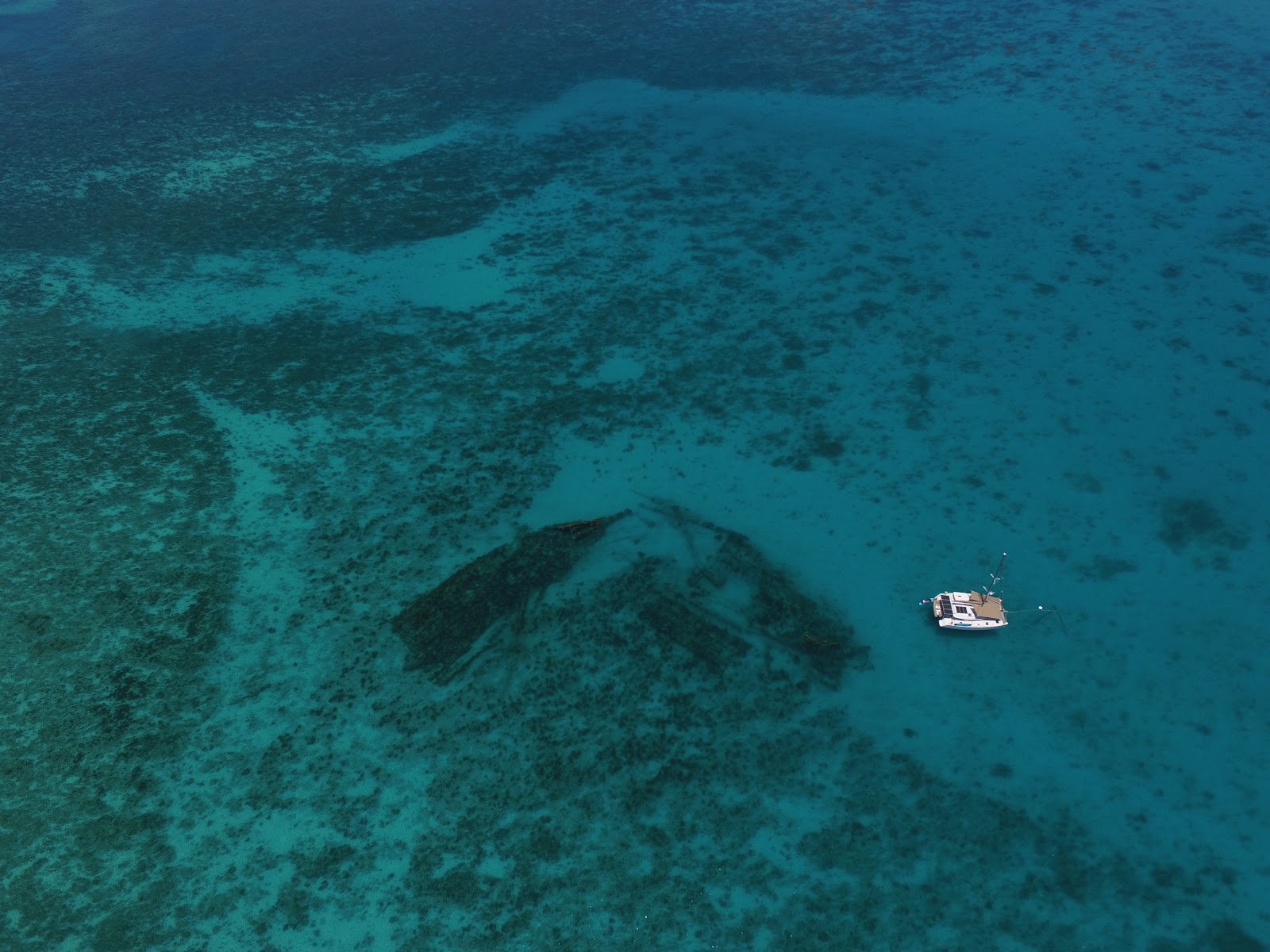
There is a “blue hole” (some called it a “black hole”) at Hoffman’s that was quite famous, which we set out to find. After a few wrong paths, we found the correct one, and came upon this hole. It was quite incredible. We saw 3 turtles swimming in it, and wondered how they had gotten there…this deep, landlocked hole, filled with water, in the middle of the island! We decided it had to somehow be connected to the ocean via an underwater tunnel for the turtles to be there. How else could they have gotten there? We hadn’t known what we would find, so we didn’t have our swimming gear with us, and it was late in the day, so we decided to come back the following day to swim in the hole.

Our drone captures this image of the Blue Hole (the front, round hole), with Cool Runnings anchored off Hoffman's Cay
Photos of the Blue Hole


The next day, after school and chores were done, we headed back to the blue/black hole, this time armed with swim suits and snorkels. The first dip revealed cool, clear water. A short dive down into the black depths, revealed hot water!! It was usually the other way around! We had fully expected to feel the water temperature decrease the deeper you dove. But with warm water underneath and cool water on the surface, we could only deduce that it was being fed by thermal vents from within the depths of the earth. How deep the hole actually is, we didn’t know (and have not had the opportunity to research), but it was a weird sensation swimming in this hot/cold water, and not knowing where the bottom was. Being used to swimming in the crystal clear Bahamian waters, and always being able to see the bottom, swimming in this never ending blackness was a little creepy for me! My imagination ran wild thinking of the monsters that lurked below!!

The kids are already in the water, coaxing me to get in!

The kids decided it would be fun to jump from a cliff ledge, perched about 30 feet above the edge, into the water below. Gaby was the first to suggest it, but Dave was the first to jump. Then Gaby got up the courage and jumped. Benjamin was next, and they loved it! They urged me to jump. “C’mon, Mom, you can do it! We all have to jump!”. Ugh…how could I be the scaredy cat? After all, hadn’t I almost sailed around the world? Hadn’t I weathered storms and big seas? Hadn’t I once before bungee jumped (yes, I had!). What’s jumping 30 ft into an inky well of nothingness?! I remember doing this when I was a kid and our family would spend summer holidays at Uvongo on the south coast of Kwa Zulu Natal, about 2 hours drive from our family home in South Africa. There was a cliff we would jump off of into the lagoon below. The higher we could climb and jump, the more fun it was. Strange how age and being a parent changes you from a carefree cliff jumper into an apprehensive, nervous Nellie! My heart was pumping and it took some coaxing from the rest of the family, but I did it…I jumped! And it was fun, but once was enough for me! The kids kept running from our cave below to the ledge on top and jumped a couple of times each, just as I had in Uvongo, so many, many years ago!

Ben gets ready, looking over the edge....and then jumps!  Gaby's view as she looks down at Ben in the water and Mom and Dad looking on...and then she's also in mid-air!

To get from Hoffman’s Cay to Great Harbor Cay we had to negotiate some very shallow patches. We also had to exit the shelter of the Cays and sail on the “outside” because the inside route was too shallow. We had listened to, and then spoken to, a small boat with a shallower draft than ours, who had attempted the inside route together with another boat the day before, but they both had to turn around after running aground too many times. Just getting to the pass to get out was a challenge, with us having to turn around once, after our keels gently kissed the sand below, and we knew we couldn’t make it any further!

Shallow, shallow water...but oh, so pretty! 
Dave scanning the shallow waters as Gaby stands in the sail bag to get higher up and spots a safe route out

But once out, we had a great sail around the rest of the islands and over the top of Great Harbor Cay. The very top island is called Small Stirrup Cay, and is used by the cruise ships as a stop over. There was one cruise ship anchored off when we sailed by. Little boats ferried the passengers to and from the ship, while its occupants enjoyed the sandy shores and warm waters of the Cay. Hundreds of umbrellas and chairs lined the beaches and the contrast of what we had just left behind, complete isolation & natural untouched beauty, to what we were seeing now, took a little time to comprehend! But this was their paradise, if not ours, and we realize that we are so very lucky to be able to experience the solitude of the uninhabited islands, to move our little home to wherever we want, whenever we want.

The cruise ship and its occupants

Our fishing lines were out and we trawled as we sailed on by. Other than the mackerel we caught just as we were coming into the pass at Bond Cay about a week earlier, we had not had much luck fishing. All of a sudden, we had a fish on the line! Dave reeled it in, and it looked to be a great fish! It was a good size, but we were unable to identify it, and being a little weary of ciguatera poisoning, we decided to let it go. Ciguatera poisoning is quite prevalent in the Florida Keys and the Bahamas and is a result of consuming larger fish that eat the smaller reef fish that eat the coral. Symptoms include nausea, diarrhea, very low blood pressure, joint and other pains and a host of other ailments. It can be dangerous and possibly deadly, depending on the degree of poisoning. About an hour or two later, we had another fish on the line…another great size and good looking fish! We quickly scanned our fish identification books and although we were not 100% sure of the exact type, we were pretty certain it was a snapper, and decided to keep it. Photos were taken and sent to more experienced fishermen (nephews back in Florida) for further identification, and confirmation of its type came back as a mutton snapper…good to eat!! Yay! (Thank you, Ashton!).

Dave with the catch of the day!
 
By this time we were now around the corner and once again in the lee of the island, Great Harbor Cay. All traces of the cruise ship and its passengers were gone, and we were faced with a calm, open bay with only one other boat anchored there. It was the boat we were looking for: s/v Pandion. Gary and Brenda had let us know that they were out on their dinghy, so we knew they were not aboard. We anchored next to them and Dave went about the task of cleaning and filleting the big fish. Not too long after, a dinghy came to our stern. It was Gary and Brenda returning from their excursion! It was so great to see them again after all this time since our brief meeting in the Dry Tortugas just over 2 years ago! Gary also identified our fish as a mutton snapper, and told us that he had had ciguatera poisoning after eating a fish in a restaurant in Nassau a few years prior! He said it took a couple of years for the symptoms to completely go away. If he was happy to eat the snapper after having suffered from ciguatera poisoning, we knew it was definitely fine to eat!!

Gary and Brenda had invited us to dinner aboard Pandion that evening, so we were happy to be able to contribute! We decided to bring the fish, and Brenda made rice and a green salad, something we had not seen for quite a while!! And of course, we brought the famous bottle of champagne! It turned out that we had so much fun and did so much talking, that we forgot to drink the champagne that night!! It stayed on Pandion until the next night, when we got together again for dinner, this time onboard Cool Runnings. Before our dinner of hot dogs that Gary and Brenda brought over, we finally popped that well-traveled bottle of champagne and toasted to a new friendship borne out of a short dinghy ride to say hi in April 2016!

Another shot with the now famous bottle of champagne!

By now, Alberto had made its path more well known, and we looked like we would be spared the brunt of it, as the storm would move into the Gulf of Mexico and up the west coast of Florida and into the pan handle. We cancelled our marina reservations, but decided to stay anchored off Cistern Cay with Pandion and wait for the weather to pass. We had 2 days of torrential rain, and wind gusts up to 30 – 35 knots, but we were sheltered and safe.

To pass the time, we went on a rain-soaked walk and explored a drug lord’s house that had been abandoned and left to decay. How quickly they abandoned it was evidenced by a car still parked in the garage, now stripped and rusting in the elements. In its day, the house must have been grand, but the termites have ravaged the wooden beams, and the elements have found their way into the house through the holes in the roof. There was even a ramp for a seaplane. How easily they would have been able to smuggle the drugs in and out of the Bahamas back in the day!

A once beautiful house left to decay

By Monday morning, May 28th, the worst of the storm was over, and, after having said our farewells to Gary and Brenda the evening before, we decided to leave as planned. We had a long day ahead of us, about 80 miles from the Berry Islands to North Cat Cay, the jumping off point for our trip across the Gulf Stream and back home to the United States of America.